14 77 56 Wander-Points
14 77 56

Wandelknooppunten-routes voor je iPhone. Walking node-network routes for your iPhone.

Kies hoe ver je wilt lopen en door wat voor landschap — bos, heide, duinen, water of stad. De app stelt zelf een rondwandeling over knooppunten samen, met het bospad als eerste keus. Onderweg zie je alleen wat je nodig hebt om het volgende bordje te halen. Pick how far you want to walk and through what kind of landscape — forest, heath, dunes, water or town. The app builds a knooppunten loop for you, with the forest path as first choice. On the way you only see what you need to reach the next sign.

Nu in TestFlight-beta Now in TestFlight beta

Wat de app doet What the app does

Route-plannerRoute planner

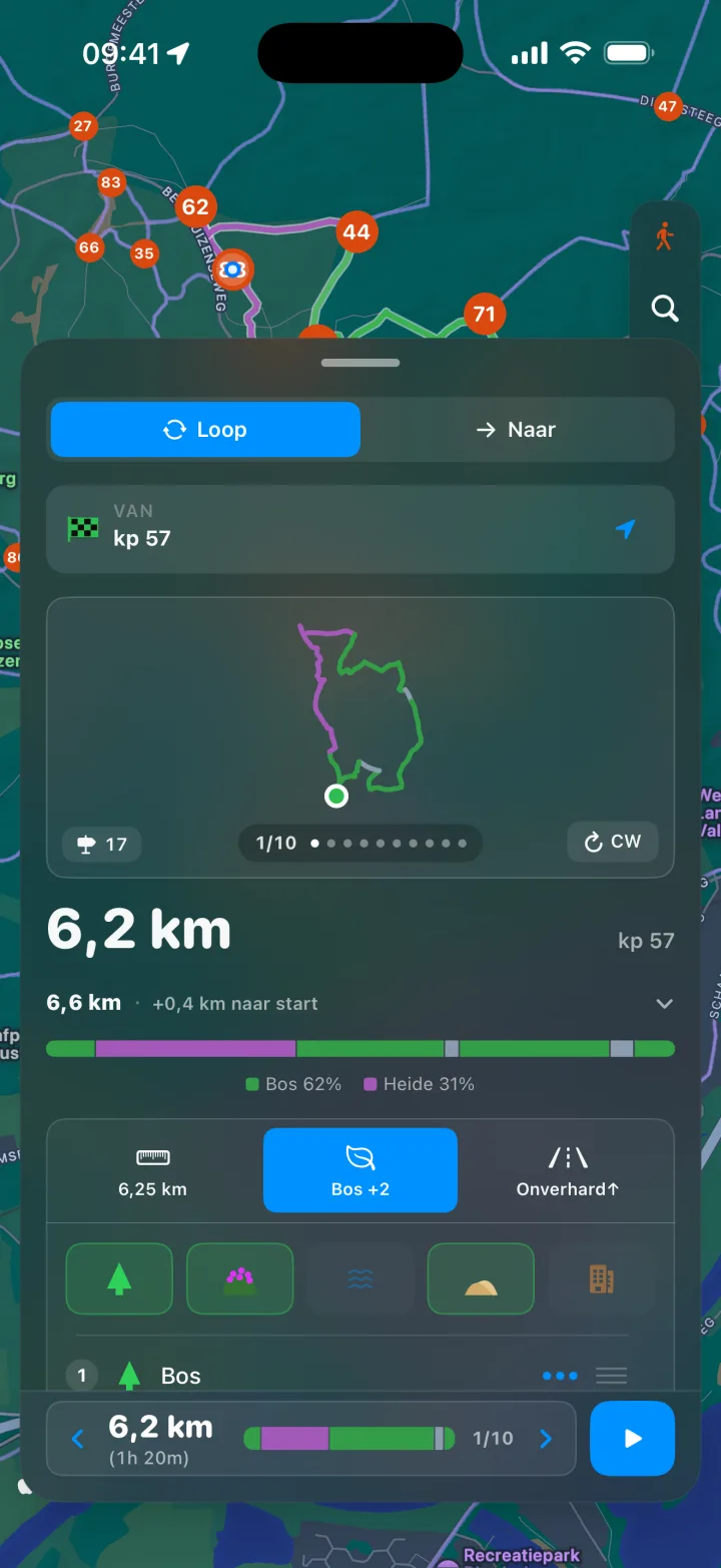
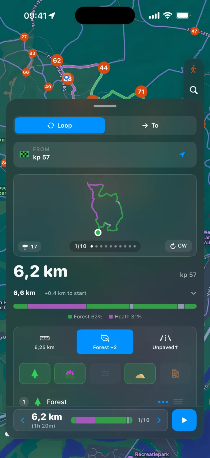
Kies een afstand en de app stelt direct rondwandelingen voor vanaf het dichtstbijzijnde knooppunt — van een half uur tot een dag. Stuur 'm bij door knooppunten toe te voegen die je wilt meepakken. Pick a distance and the app suggests loops from the nearest junction right away — from half an hour to a full day. Steer it by adding knooppunten you'd like to pass through.

Landschap-filtersLandscape filters

Sleep bos, heide, duinen, water en stad in de volgorde waarin je ze wilt tegenkomen. De planner past de route daarop aan en laat zien hoeveel van elk je onderweg krijgt. Drag forest, heath, dunes, water and town into the order you want to meet them. The planner shapes the route to match and shows how much of each you'll get.

Loop naar een bestemmingWalk to a destination

Geen rondje maar een doel? Zoek een adres, kies een opgeslagen plek of tik ergens op de kaart. De route volgt het knooppuntennetwerk en leidt je de eerste en laatste meters naar de deur. Bewaar Thuis, Werk en favorieten als pins. Not a loop but a target? Search an address, pick a saved place or tap anywhere on the map. Your route follows the knooppunt network and guides you the first and last stretch to the door. Save Home, Work and favourites as pins.

Minimalistisch navigerenMinimal navigation

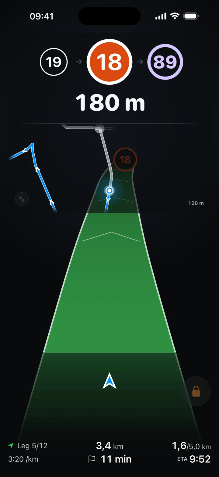
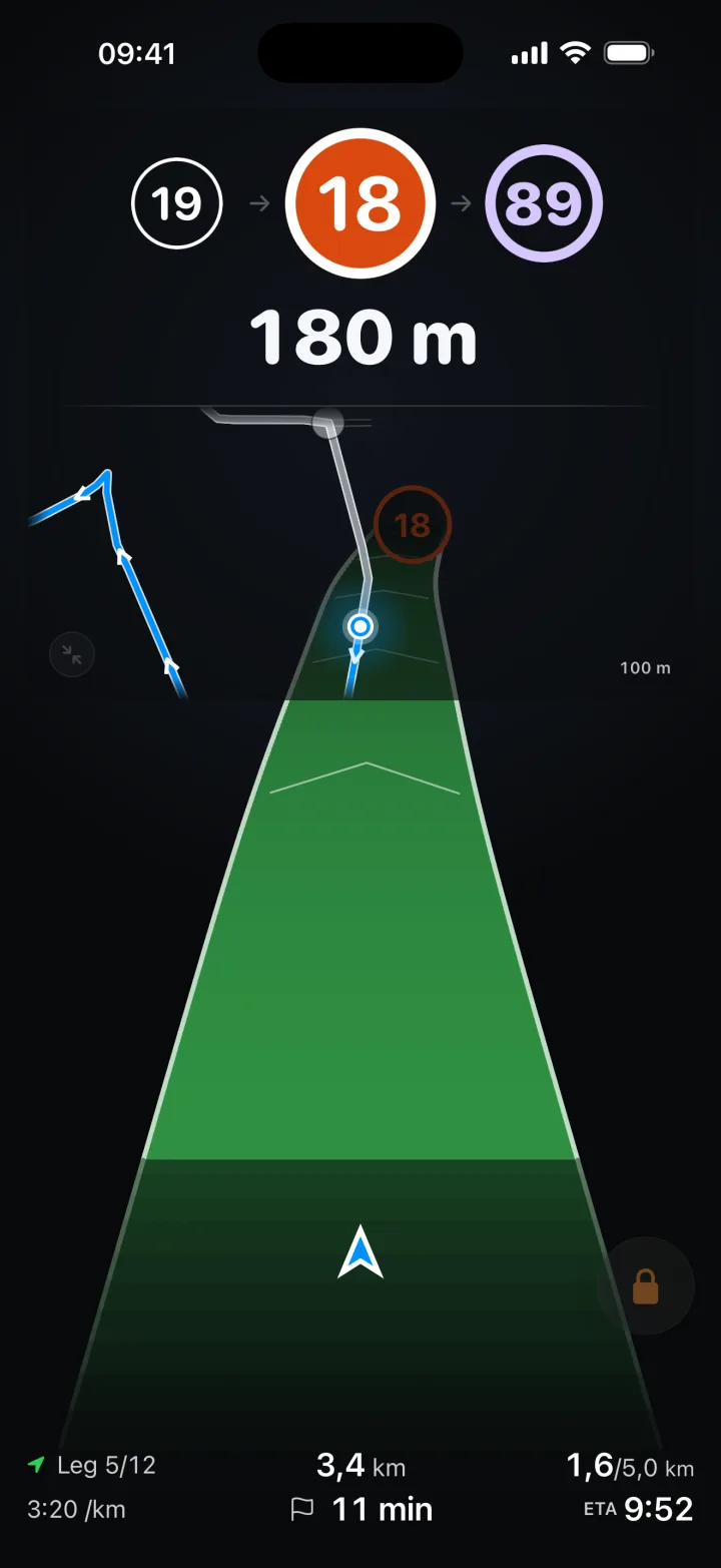
Onderweg ligt je route als een lint vóór je, met het volgende knooppunt en de afstand erbij. Geen drukke kaart, geen straatnamen — je volgt de bordjes, het lint laat zien dat je goed zit. On the way your route lies ahead of you as a ribbon, with the next knooppunt and the distance. No busy map, no street names — you follow the signs, the ribbon shows you're on track.

Onverhard eerstUnpaved comes first

Een wandelaar zoekt het bospad juist op in plaats van het te vermijden. Zo staat de app dan ook ingesteld als je 'm opent — en je kunt het omzetten naar neutraal of naar verhard, per route. A walker seeks the forest path out rather than avoiding it. That's how the app arrives when you open it — and you can turn it around to neutral or to paved, per route.

Apple WatchApple Watch

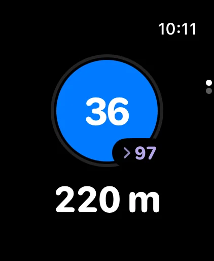
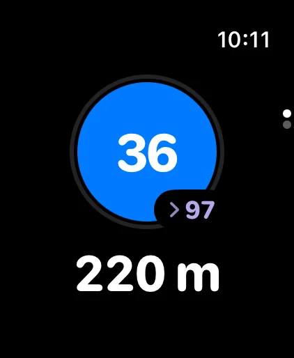
Het volgende knooppunt en de afstand ernaartoe groot op je pols, zodat je telefoon in je zak kan blijven. Een zachte tik als je een knooppunt nadert, en meteen voelbaar als je van de route raakt. The next knooppunt and the distance to it, large on your wrist, so your phone can stay in your pocket. A gentle buzz as you near a junction, and immediate feedback if you drift off-route.

Samen wandelenWalk together

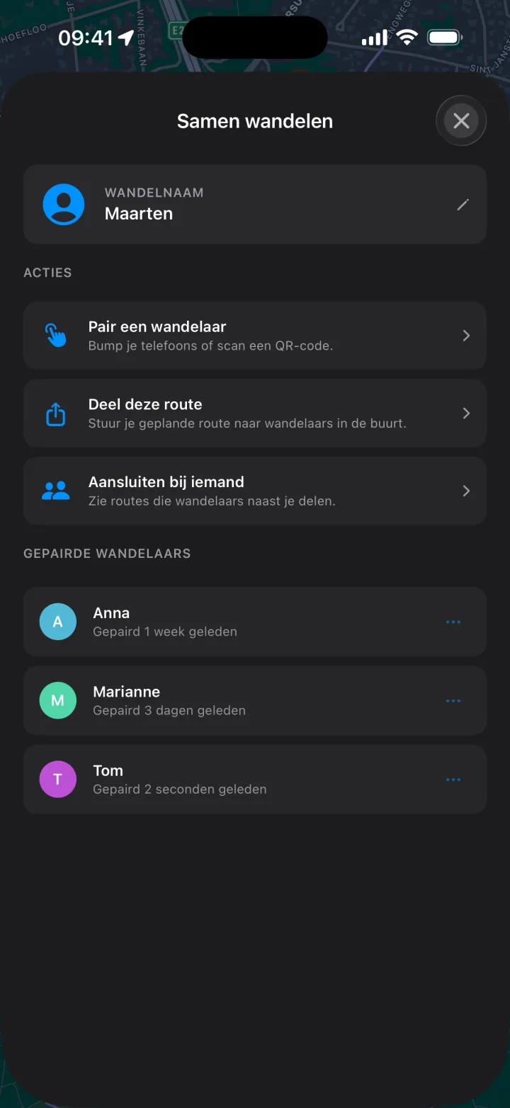
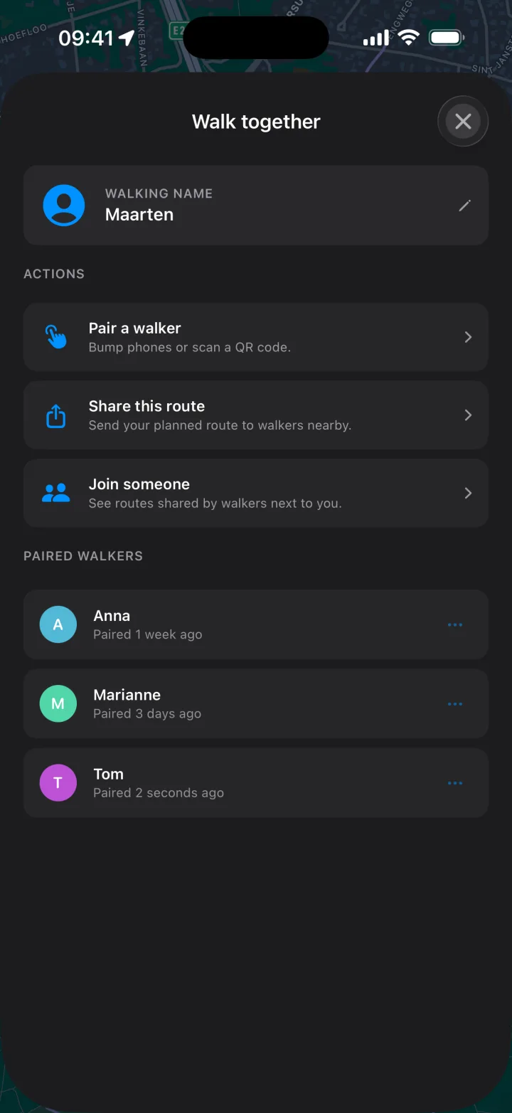
Koppel met een medewandelaar via een tik of QR-code en deel je route — vooraf of onderweg. Over je lokale netwerk, zonder account of cloud. Pair with another walker via a tap or QR code and share your route — before or during the walk. Over your local network, no account or cloud.

Wandelworkout in HealthWalking workout in Health

Je wandeling komt als wandelworkout in je eigen Health-app te staan, met route, afstand en calorieën. Achteraf zie je een overzicht met looptijd, tempo en stappen. Your walk lands in your own Health app as a walking workout, with route, distance and calories. Afterwards you get a recap with walking time, pace and steps.

Offline & privéOffline & private

Het complete wandelknooppunten-netwerk van Nederland zit in de app. Alles werkt offline en blijft op je toestel — geen account, geen tracking, geen server. The full walking knooppunten network of the Netherlands is in the app. Everything works offline and stays on your device — no account, no tracking, no server.

Zo werkt het How it works

  1. Plan je wandeling Plan your walk

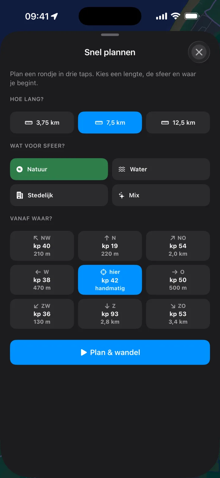
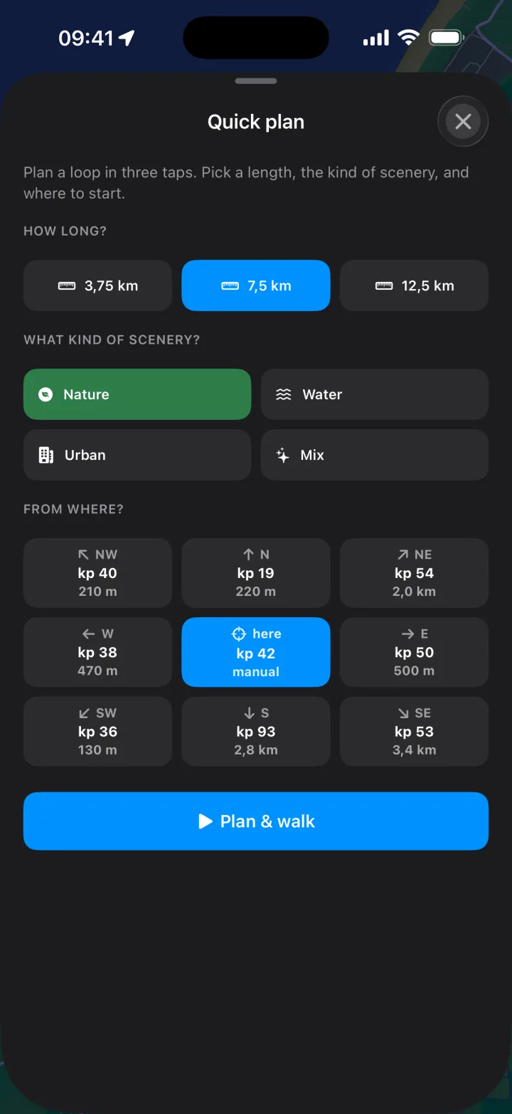
    Kies in drie taps een afstand, het landschap en waar je begint — de app stelt direct rondwandelingen voor vanaf het dichtstbijzijnde knooppunt. Bedoeld voor het moment dat je ergens staat en zin hebt om te lopen. In three taps pick a distance, the landscape and where you start — the app suggests loops from the nearest junction right away. Made for the moment you're standing somewhere and feel like walking.

    Quick plan: choose distance, landscape and start knooppunt Quick plan: choose distance, landscape and start knooppunt
  2. Of stel het fijner in Or fine-tune it

    Wil je meer sturing dan de drie taps? Sleep bos, heide, duinen, water en stad in jouw volgorde en zet de ondergrond op onverhard, neutraal of verhard — de planner past de route daarop aan en laat de verdeling zien. Want more control than the three taps? Drag forest, heath, dunes, water and town into your order and set the surface to unpaved, neutral or paved — the planner shapes the route to match and shows the breakdown.

    Landscape filter with drag-reorder priority list and surface preference Landscape filter with drag-reorder priority list and surface preference
  3. Wandel samen Walk together

    Koppel met een medewandelaar via een tik of QR-code en deel je route met wandelaars in de buurt — voor of tijdens de wandeling. Alles gaat rechtstreeks tussen de telefoons. Pair with another walker via a tap or QR code and share your route with walkers nearby — before or during the walk. Everything goes straight between the phones.

    Walk-together hub: pair a walker, share a route, join someone Walk-together hub: pair a walker, share a route, join someone
  4. Volg de bordjes Follow the signs

    De app wijst je naar het volgende knooppunt en hoe ver het is, en legt je route als een lint vóór je neer. Jij volgt de officiële wandelknooppunt-bordjes; het lint laat zien dat je goed zit en welke kant het opgaat. The app points you to the next knooppunt and how far it is, and lays your route out ahead as a ribbon. You follow the official walking knooppunt signs; the ribbon shows you're on track and which way it bends.

    Minimal navigation while walking Minimal navigation while walking
  5. Of vanaf je pols Or from your wrist

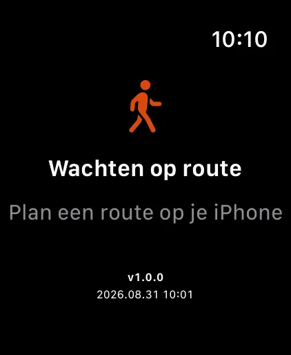
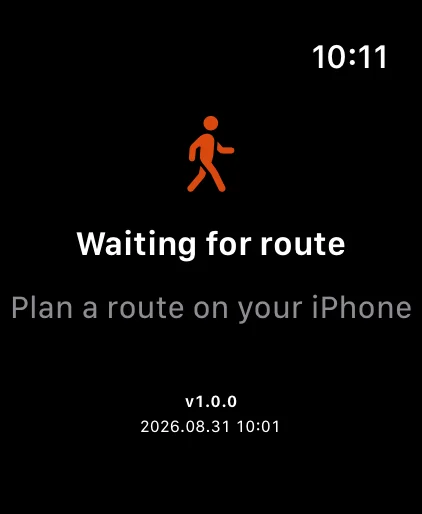
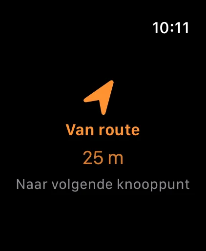
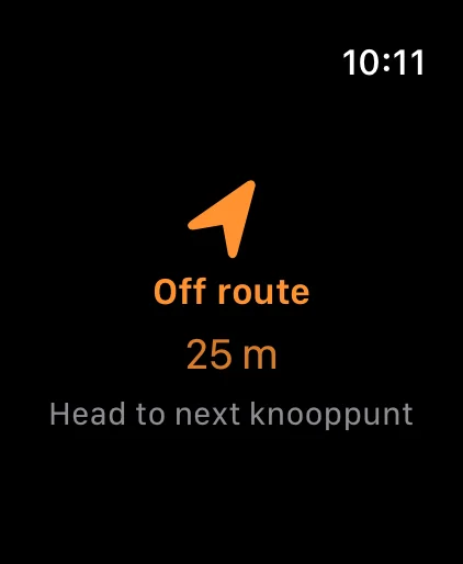
    Liever je telefoon in je zak houden? Navigeer dan vanaf je Apple Watch. Voor de start wacht 'ie rustig op je iPhone; onderweg vullen het volgende knooppunt, het knooppunt daarna en de afstand het scherm. Een zachte tik telt af naar het knooppunt, en raak je van de route, dan voel én zie je het meteen. Prefer to keep your phone in your pocket? Navigate from your Apple Watch instead. Before you set off it quietly waits for your iPhone; on the way the next knooppunt, the one after it and the distance fill the screen. A gentle buzz counts down to the junction, and if you drift off-route you feel and see it straight away.

    Apple Watch waiting for the iPhone before a walk Apple Watch waiting for the iPhone before a walk
    Apple Watch showing next knooppunt and distance Apple Watch showing next knooppunt and distance
    Apple Watch off-route warning Apple Watch off-route warning
  6. Rond af Wrap up

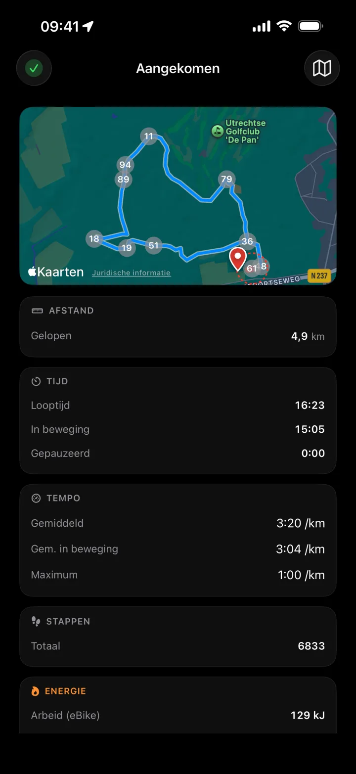
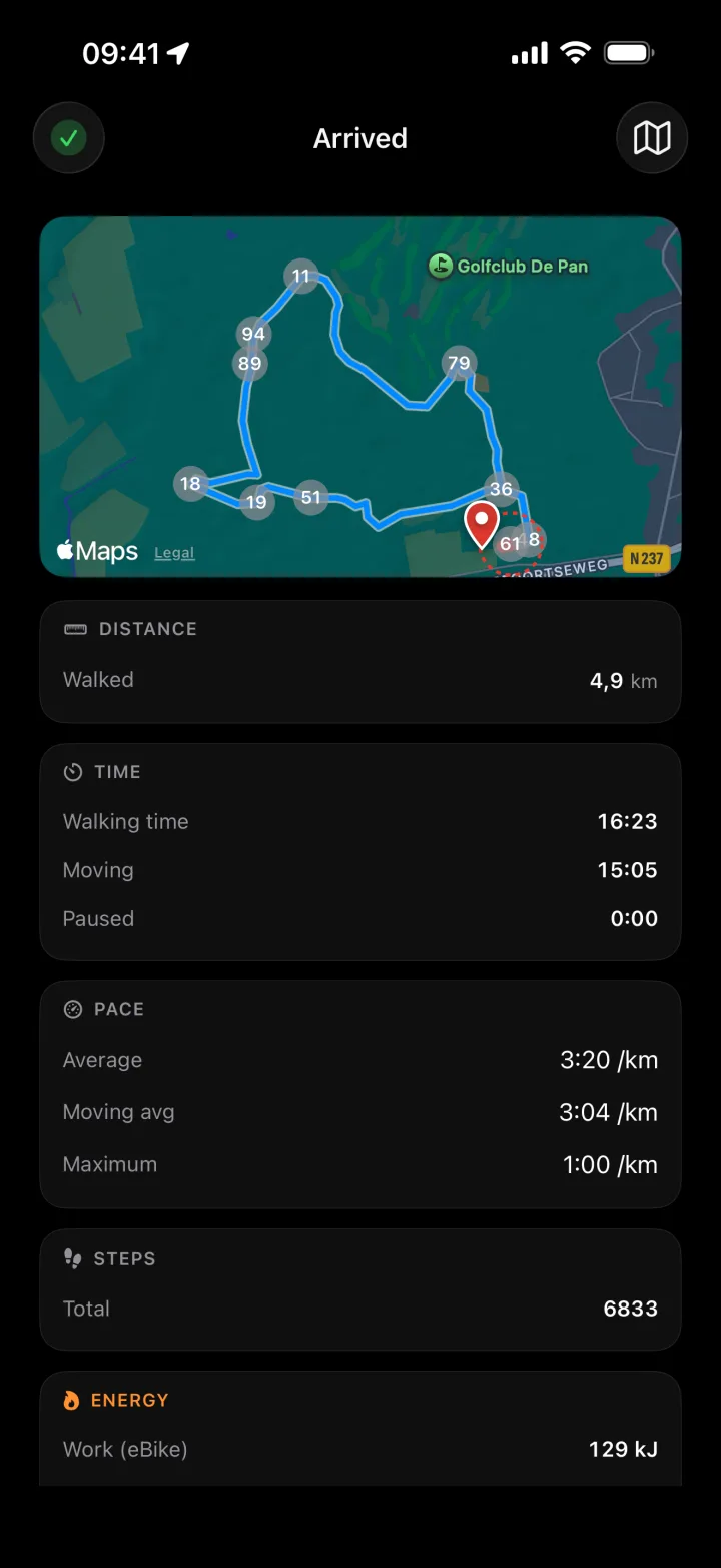
    Klaar met lopen? Je krijgt een volledig overzicht — je gelopen track op de kaart, afstand, looptijd, tempo en het aantal stappen. De wandeling staat dan ook als workout in je Health-app. Done walking? You get a full recap — your walked track on the map, distance, walking time, pace and step count. The walk also lands as a workout in your Health app.

    Walk recap: walked track on the map with distance, time, pace and steps Walk recap: walked track on the map with distance, time, pace and steps

Support Support

Bug gevonden? Vraag of feedback? Stuur een mailtje — ik lees alles zelf.

E-mailsupport@wander-points.app

Goed om te weten

Heb ik internet nodig tijdens het wandelen? Voor de navigatie niet — knooppunten en routes zitten lokaal in de app, je krijgt simpele "ga naar het volgende knooppunt"-aanwijzingen. Wil je een kaart zien (bij het plannen of als optie onderweg), dan heb je internet nodig — die wordt gerenderd via Apple Maps.

Worden mijn wandelingen ergens opgeslagen? Alleen als wandelworkout in jouw eigen Health-app, met afstand en route. Wander-Points zelf bewaart niets.

Welke iOS-versie heb ik nodig? iOS 18 of hoger op de iPhone, watchOS 11 of hoger op de Watch.

Werken mijn opgeslagen plekken op mijn andere apparaten? Ja — je opgeslagen plekken, voorkeuren en gekoppelde medewandelaars synchroniseren via iCloud tussen je apparaten. Per apparaat uit te zetten.

Werkt de app ook in België? Nog niet. Versie 1 dekt Nederland; België volgt pas als de wandeldata het draagt.

Fiets je ook? Voor fietsknooppunten in Nederland én België is er een zusterapp: Velo-Points.

Found a bug? Question or feedback? Drop me a line — I read everything myself.

Emailsupport@wander-points.app

Good to know

Do I need internet while walking? Not for navigation — knooppunten and routes are stored on-device, so directions work offline. To view a map (when planning, or optionally on the way), you do need internet — those map tiles come from Apple Maps.

Are my walks stored anywhere? Only as a walking workout in your own Health app, with distance and route. Wander-Points itself stores nothing.

Which iOS version do I need? iOS 18 or later on iPhone, watchOS 11 or later on Watch.

Do my saved places sync across my devices? Yes — your saved places, preferences and paired walkers sync over iCloud between your devices. You can turn it off per device.

Does the app work in Belgium? Not yet. Version 1 covers the Netherlands; Belgium follows once the walking data supports it.

Do you cycle too? For cycling knooppunten in the Netherlands and Belgium there's a sister app: Velo-Points.